Publications
publications by categories in reversed chronological order. generated by jekyll-scholar.
2025
-
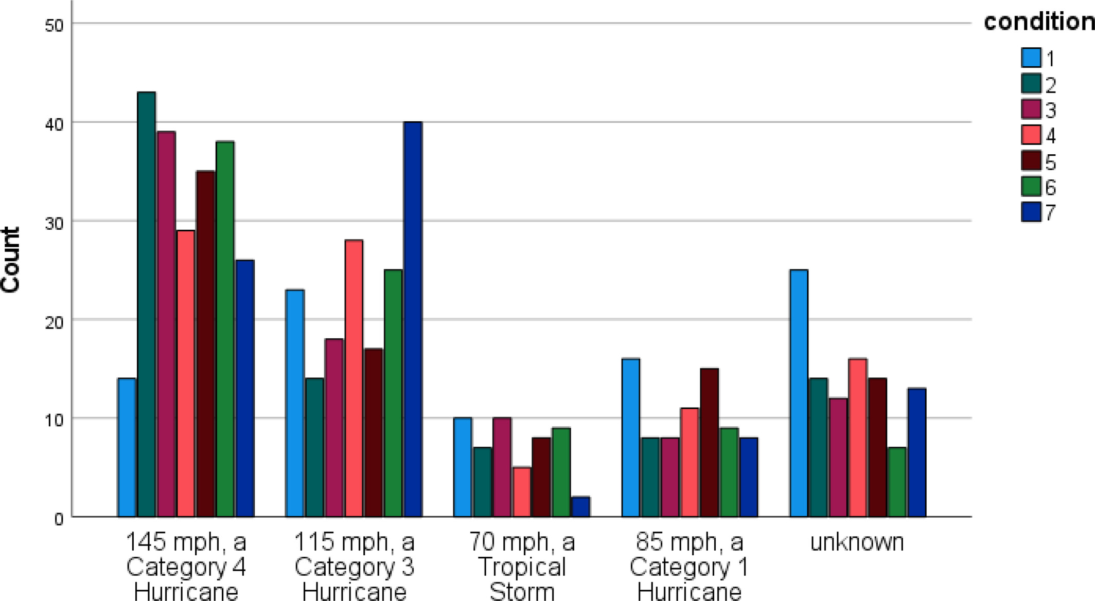 Developing Experimental Probabilistic Intensity Forecast Products for Landfalling Tropical CyclonesRobert Eicher, Daniel J. Halperin, Benjamin C. Trabing, and 4 more authorsMeteorological Applications, 2025
ABSTRACT An increasing body of evidence indicates that publics want more probabilistic information included in their weather forecasts. However, more guidance on incorporating probability information into weather risk communication is needed. The National Hurricane Center (NHC) recently developed prototype forecast graphics that include probabilistic values of intensity at landfall when landfall is possible. The goal of this research was to develop those prototypes into a forecast product that expresses technical uncertainty in an intensity forecast in a manner that is understandable and effective to various publics. In Study 1, an online survey among Florida residents was conducted. Quantitative analysis of the survey data showed few significant differences between the prototypes and the currently operational forecast track graphic, commonly referred to as the cone of uncertainty (COU). Analysis of the responses to open-ended questions in the survey and feedback from focus group participants consisting of NHC partners working in hurricane-prone areas guided revisions to improve the prototypes. In Study 2, the modified prototypes produced an improvement in understanding of certain aspects of the intensity forecast. Promisingly, most people surveyed preferred the additional probabilistic information in the prototypes to the status quo COU message. In fact, nearly 90% of respondents indicated that they preferred at least some percentage values in their weather forecasts as opposed to forecasts with words only. This suggests that further development of a probabilistic landfall intensity product might be warranted.
@article{https://doi.org/10.1002/met.70089,
  author = {Eicher, Robert and Halperin, Daniel J. and Trabing, Benjamin C. and Lane, Derek and Sellnow, Deanna and Sellnow, Timothy and Croker, Madison},
  title = {Developing Experimental Probabilistic Intensity Forecast Products for Landfalling Tropical Cyclones},
  journal = {Meteorological Applications},
  volume = {32},
  number = {4},
  pages = {e70089},
  keywords = {probabilstic forecasting, risk communication, tropical cyclones},
  doi = {10.1002/met.70089},
  year = {2025},
}
2024
-
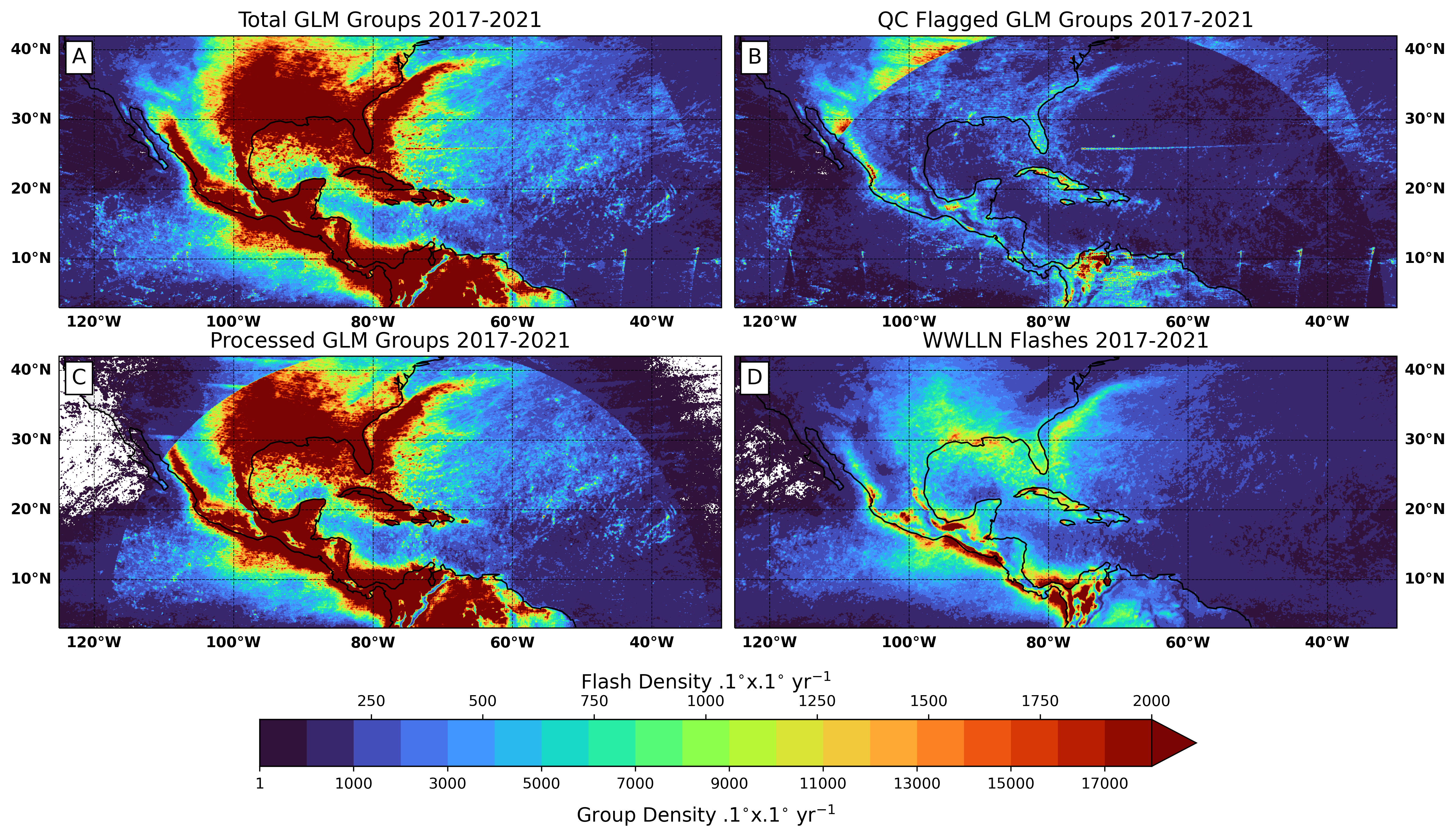 Quality Control of Geostationary Lightning Mapper Observations for Tropical Cyclone ApplicationsBenjamin C. Trabing, Kyle Hilburn, Stephanie Stevenson, and 2 more authorsJournal of Atmospheric and Oceanic Technology, 2024
The Geostationary Lightning Mapper (GLM) has been providing unprecedented observations of total lightning since becoming operational in 2017. The potential for GLM observations to be used for forecasting and analyzing tropical cyclone (TC) structure and intensity has been complicated by inconsistencies in the GLM data from a number of artifacts. The algorithm that processes raw GLM data has improved with time; however, the need for a consistent long-term dataset has motivated the development of quality control (QC) techniques to help remove clear artifacts such as blooming events, spurious false lightning, ‘bar’ effects, and sun glint. Simple QC methods are applied that include scaled maximum energy thresholds and minima in the variance of lightning group area and group energy. QC and anomaly detection methods based on machine learning (ML) are also explored. Each QC method is successfully able to remove artifacts in the GLM observations while maintaining the fidelity of the GLM observations within TCs. As the GLM processing algorithm has improved with time, the amount of QC flagged lightning within 100 km of Atlantic TCs is reduced, from 70% during 2017, to 10% in 2018, to 2% during 2021. These QC methods are relevant to the design of ML-based forecasting techniques which could pick up on artifacts rather than the signal of interest in TCs if QC wasn’t applied beforehand.
@article{https://doi.org/10.1029/2024GL109663, author = {Trabing, Benjamin C. and Hilburn, Kyle and Stevenson, Stephanie and Musgrave, Kate and DeMaria, Mark}, title = {Quality Control of Geostationary Lightning Mapper Observations for Tropical Cyclone Applications}, journal = {Journal of Atmospheric and Oceanic Technology}, volume = {41}, number = {9}, pages = {889 - 901}, doi = {10.1175/JTECH-D-23-0138.1}, year = {2024}, } -
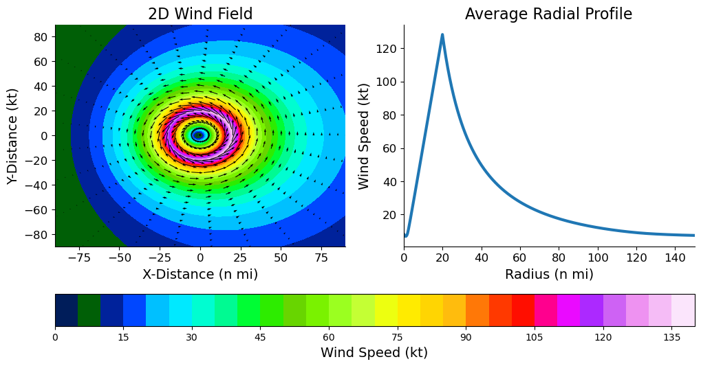 Are Forecasts of the Tropical Cyclone Radius of Maximum Wind Skillful?Benjamin C. Trabing, Andrew B. Penny, Jonathan Martinez, and 1 more authorGeophysical Research Letters, 2024e2024GL109663 2024GL109663
The radius of maximum wind (RMW) defines the location of the maximum winds in a tropical cyclone and is critical to understanding intensity change as well as hazard impacts. A comparison between the Hurricane Analysis and Forecast System (HAFS) models and two statistical models based off the National Hurricane Center official forecast is conducted relative to a new baseline climatology to better understand whether models have skill in forecasting the RMW of North Atlantic tropical cyclones. On average, the HAFS models are less skillful than the climatology and persistence baseline and two statistically derived RMW estimates. The performance of the HAFS models is dependent on intensity with better skill for stronger tropical cyclones compared to weaker tropical cyclones. To further improve guidance of tropical cyclone hazards, more work needs to be done to improve forecasts of tropical cyclone structure.
@article{https://doi.org/10.1029/2024GL109664,
  author = {Trabing, Benjamin C. and Penny, Andrew B. and Martinez, Jonathan and Fritz, Cody},
  title = {Are Forecasts of the Tropical Cyclone Radius of Maximum Wind Skillful?},
  journal = {Geophysical Research Letters},
  volume = {51},
  number = {12},
  pages = {e2024GL109663},
  keywords = {tropical cyclone, radius of maximum winds, HAFS, numerical weather prediction models},
  doi = {10.1029/2024GL109663},
  eprint = {https://agupubs.onlinelibrary.wiley.com/doi/pdf/10.1029/2024GL109663},
  note = {e2024GL109663 2024GL109663},
  year = {2024},
}
2023
-
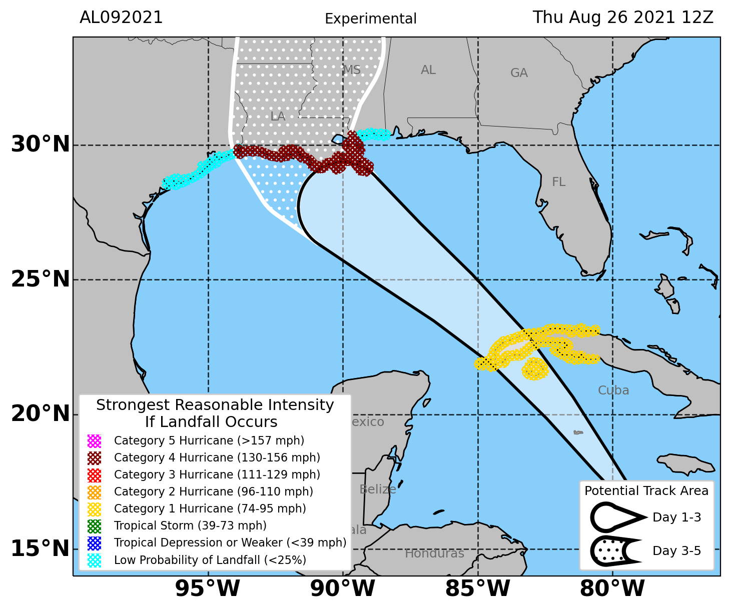 The Development and Evaluation of a Tropical Cyclone Probabilistic Landfall Forecast ProductBenjamin C. Trabing, Kate D. Musgrave, Mark DeMaria, and 3 more authorsWeather and Forecasting, 2023
@article{TheDevelopmentandEvaluationofaTropicalCycloneProbabilisticLandfallForecastProduct,
  author = {Trabing, Benjamin C. and Musgrave, Kate D. and DeMaria, Mark and Zachry, Brian C. and Brennan, Michael J. and Rappaport, Edward N.},
  title = {The Development and Evaluation of a Tropical Cyclone Probabilistic Landfall Forecast Product},
  journal = {Weather and Forecasting},
  year = {2023},
  publisher = {American Meteorological Society},
  address = {Boston MA, USA},
  volume = {38},
  number = {8},
  doi = {10.1175/WAF-D-22-0199.1},
  pages = {1363 - 1374},
}
2022
- A Simple Bias and Uncertainty Scheme for Tropical Cyclone Intensity Change ForecastsBenjamin C. Trabing, K. D. Musgrave, M. DeMaria, and 1 more authorWeather and Forecasting, 2022
@article{ASimpleBiasandUncertaintySchemeforTropicalCycloneIntensityChangeForecasts,
  author = {Trabing, Benjamin C. and Musgrave, K. D. and DeMaria, M. and Blake, E.},
  title = {A Simple Bias and Uncertainty Scheme for Tropical Cyclone Intensity Change Forecasts},
  journal = {Weather and Forecasting},
  year = {2022},
  publisher = {American Meteorological Society},
  address = {Boston MA, USA},
  volume = {37},
  number = {11},
  doi = {10.1175/WAF-D-22-0074.1},
  pages = {1957 - 1972},
}
2021
-
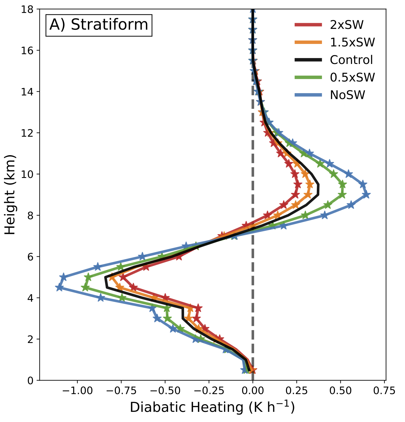 The Sensitivity of Eyewall Replacement Cycles to Shortwave RadiationB. C. Trabing, and M. M. BellJournal of Geophysical Research: Atmospheres, 2021e2020JD034016 2020JD034016
The sensitivity of tropical cyclone secondary eyewall formation (SEF) and subsequent eyewall replacement cycles (ERCs) to shortwave radiation is examined in this study by varying the solar constant and diurnal cycle at different times prior to an ERC using idealized simulations from the Weather Research and Forecasting model. The magnitude of shortwave radiation plays an important role in modifying the timing of the SEF with nonlinear interactions amplifying the SEF formation differences at longer lead-times. Shortwave radiation has a delaying effect on the SEF and ERC primarily through its modifications of the distribution of convective and stratiform heating profiles in the rainbands. Shortwave radiation reduces both the area and diabatic heating of convection in the model domain, while increasing the amount of stratiform precipitation that has weaker low-level cooling and upper-level heating rates. The primary mechanism by which shortwave radiation reduces the diabatic heating profile and frequency of convection in the rainbands is through heating of the mid-upper troposphere which stabilizes the region and reduces convective available potential energy.
@article{https://doi.org/10.1029/2020JD034016, author = {Trabing, B. C. and Bell, M. M.}, title = {The Sensitivity of Eyewall Replacement Cycles to Shortwave Radiation}, journal = {Journal of Geophysical Research: Atmospheres}, volume = {126}, number = {8}, pages = {e2020JD034016}, keywords = {Eyewall replacement cycle, shortwave radiation, tropical cyclones}, doi = {10.1029/2020JD034016}, eprint = {https://agupubs.onlinelibrary.wiley.com/doi/pdf/10.1029/2020JD034016}, note = {e2020JD034016 2020JD034016}, year = {2021}, } - Observations of Diurnal Variability under the Cirrus Canopy of Typhoon Kong-rey (2018)Benjamin C. Trabing, and Michael M. BellMonthly Weather Review, 2021
@article{ObservationsofDiurnalVariabilityundertheCirrusCanopyofTyphoonKongrey2018, author = {Trabing, Benjamin C. and Bell, Michael M.}, title = {Observations of Diurnal Variability under the Cirrus Canopy of Typhoon Kong-rey (2018)}, journal = {Monthly Weather Review}, year = {2021}, publisher = {American Meteorological Society}, address = {Boston MA, USA}, volume = {149}, number = {9}, doi = {10.1175/MWR-D-20-0327.1}, pages = {2945 - 2964}, } - Large-Scale State and Evolution of the Atmosphere and Ocean during PISTON 2018Adam H. Sobel, Janet Sprintall, Eric D. Maloney, and 5 more authorsJournal of Climate, 2021
@article{LargeScaleStateandEvolutionoftheAtmosphereandOceanduringPISTON2018,
  author = {Sobel, Adam H. and Sprintall, Janet and Maloney, Eric D. and Martin, Zane K. and Wang, Shuguang and de Szoeke, Simon P. and Trabing, Benjamin C. and Rutledge, Steven A.},
  title = {Large-Scale State and Evolution of the Atmosphere and Ocean during PISTON 2018},
  journal = {Journal of Climate},
  year = {2021},
  publisher = {American Meteorological Society},
  address = {Boston MA, USA},
  volume = {34},
  number = {12},
  doi = {10.1175/JCLI-D-20-0517.1},
  pages = {5017 - 5035},
}
2020
-
 Understanding Error Distributions of Hurricane Intensity Forecasts during Rapid Intensity ChangesBenjamin C. Trabing, and Michael M. BellWeather and Forecasting, 2020
@article{UnderstandingErrorDistributionsofHurricaneIntensityForecastsduringRapidIntensityChanges,
  author = {Trabing, Benjamin C. and Bell, Michael M.},
  title = {Understanding Error Distributions of Hurricane Intensity Forecasts during Rapid Intensity Changes},
  journal = {Weather and Forecasting},
  year = {2020},
  publisher = {American Meteorological Society},
  address = {Boston MA, USA},
  volume = {35},
  number = {6},
  doi = {10.1175/WAF-D-19-0253.1},
  pages = {2219 - 2234},
}
2019
-
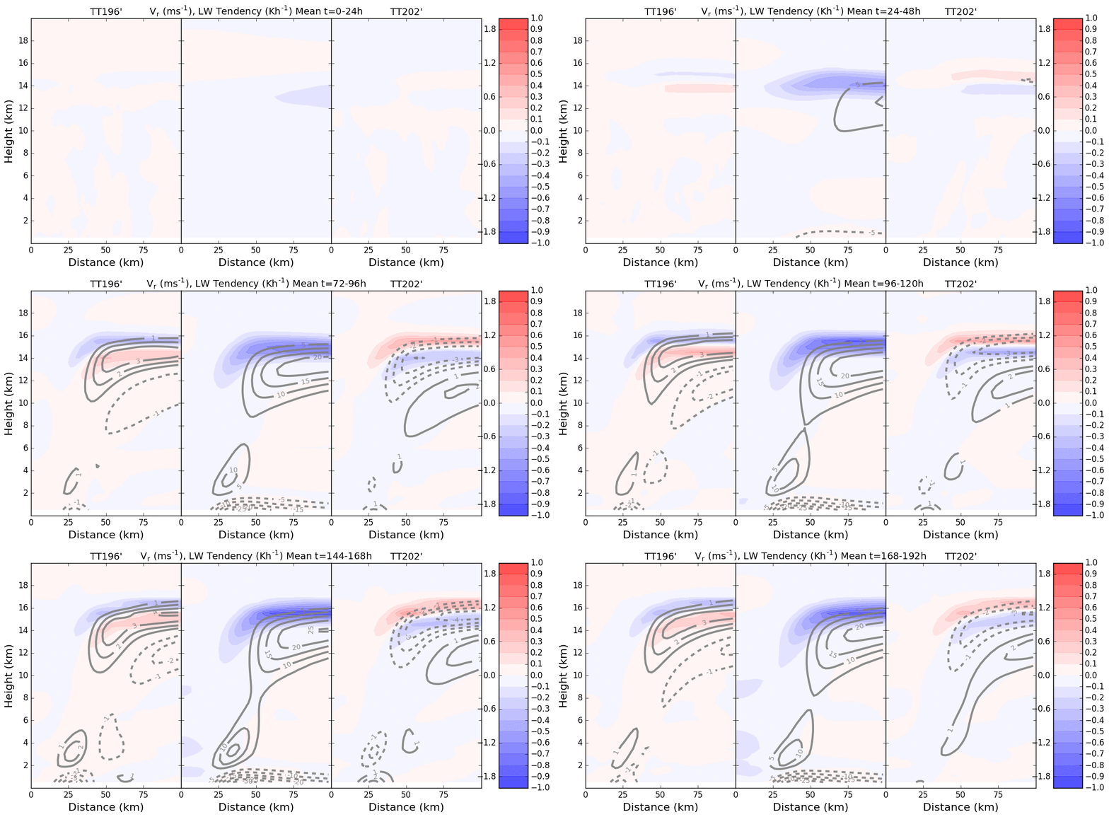 Impacts of Radiation and Upper-Tropospheric Temperatures on Tropical Cyclone Structure and IntensityBenjamin C. Trabing, Michael M. Bell, and Bonnie R. BrownJournal of the Atmospheric Sciences, 2019
@article{ImpactsofRadiationandUpperTroposphericTemperaturesonTropicalCycloneStructureandIntensity,
  author = {Trabing, Benjamin C. and Bell, Michael M. and Brown, Bonnie R.},
  title = {Impacts of Radiation and Upper-Tropospheric Temperatures on Tropical Cyclone Structure and Intensity},
  journal = {Journal of the Atmospheric Sciences},
  year = {2019},
  publisher = {American Meteorological Society},
  address = {Boston MA, USA},
  volume = {76},
  number = {1},
  doi = {10.1175/JAS-D-18-0165.1},
  pages = {135 - 153},
}
